SAN ANTONIO – A new report from the Alamo Area Metropolitan Planning Organization (AAMPO) envisions a more walkable Beacon Hill and Alta Vista, two neighborhoods that have become central to the city’s larger transportation conversation.
The two North Side neighborhoods have become a proving ground for active transportation, pedestrian and mobility-centric projects over the last year.
While the report — prepared in conjunction with the respective neighborhood associations, the City of San Antonio and VIA Metropolitan Transit officials — does not guarantee funding, it could help secure future grant opportunities for some projects, AAMPO said on its website.
You can view the full 51-page report below:
At its core, it provides a guide for neighborhoods to consider when developing policies and implementing bike or pedestrian infrastructure.
In its early pages, the report directs the conversation toward Mayor Gina Ortiz Jones and the City of San Anotnio.
“Please consider this report as COSA identifies future projects,” reads a letter to Mayor Jones.
Laying the foundation
Both neighborhoods submitted an application to AAMPO in November 2024 to initiate the development of a Walkable Community Workshop (WCW) for their respective residents, the report states.
The AAMPO describes its WCW as a way to “engage residents” in their neighborhood’s planning process. The WCW program, according to Matthew Moreno, an AAMPO regional transportation planner and architect of the report, is modeled after a national project encouraging communities to design comprehensive pedestrian and cycling systems.
Moreno said the WCW shares similarities to programs conducted throughout the country by other municipalities, MPOs and nonprofits.
Workshops in the AAMPO program include:
-
Educating communities about active transportation benefits.
-
Assisting communities in identifying policy and infrastructure improvements supporting walking and cycling.
-
Providing communities with an opportunity for two-way communication with local transportation agency staff.
The report breaks down the input from the two neighborhoods on barriers to walkability and possible infrastructure improvements to mitigate those respective issues, such as degraded sidewalks.
“Specifically, the neighborhoods were interested in improving safety, access, and mobility for those of all ages and abilities to the area’s schools and to VIA’s planned Green Line on San Pedro Avenue,” the report said.
North Side neighbors
Intersected by Blanco Road and West Woodlawn Avenue, Beacon Hill and Alta Vista feature communities primarily zoned as residential with a large presence of multifamily and single-family plats, according to the report.
The report finds that while traffic counts within the two neighborhoods are low, vehicle speeds and a lack of traffic-calming measures “play a more significant role” when considering pedestrian safety and comfort.
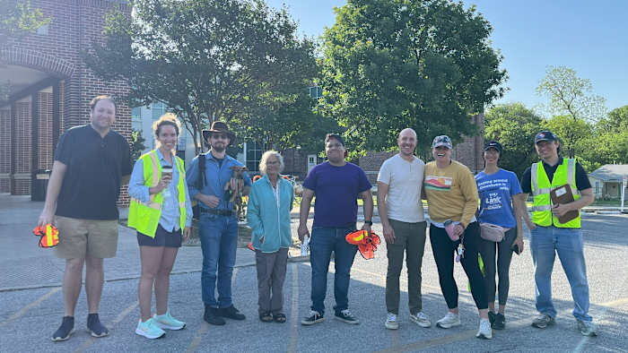
Community members from both neighborhoods participating in a workshop for the report. (Courtesy of Alamo Area Metropolitan Planning Organization)
The neighborhoods’ highest vehicle counts are seen on arterial roadways, namely Hildebrand Avenue, San Pedro Avenue, and Cypress Street, being used as through-streets.
“As a result of the traffic counts along these major thoroughfares, and speed limits of 30-35 miles per hour or more along these corridors, suggested treatments for pedestrian and cyclist infrastructure will mostly be off-street or protected,” the report said.
Investments in transit infrastructure and safety measures have driven planning in the two neighborhoods, the report describes.
Such investments as the Bike Network Plan and VIA’s Advanced Rapid Green Line exist among more immediate measures, such as the Near North Community Plan.
Proposed transit investments in the two neighborhoods
With VIA’s planned Green Line construction slated to begin next spring, the report briefly discusses a traffic calming study assessing neighborhood streets and possible vehicle through-traffic as a result of reduced travel lanes on San Pedro Avenue.
For Alta Vista, potential through-traffic concerns caused by the Green Line’s implementation are pertinent, according to Erin Zayko, a technical committee chair with the neighborhood association.
“We’re especially interested in safety around Mark Twain, along Flores St., where we have new businesses, and on streets such as Ashby and Woodlawn, where we expect cut-through traffic from the Green Line,” Zayko said in an email to KSAT.
The traffic calming study, according to the report, is expected to be released in December.
“Finding funding and neighbor consensus on traffic calming measures may be challenges, and we’re grateful to have this report from AAMPO to help guide us,” Zayko said.
ActivateSA, an active transportation advocacy organization, is named in the report for its “street audits” and an AARP-funded grant supporting the installation of two sidewalk art installations across Beacon Hill.
>> 2 San Antonio nonprofits among grant recipients for AARP community challenge
The installations would support “many of the goals” put forth in the city’s Complete Streets and Vision Zero polices, in addition to methods such as quick-build infrastructure, said ActivateSA Executive Director Joey Pawlik.
The nonprofit defines its street audits as “an assessment of the pedestrian safety, accessibility, and comfort of a particular area.” Thus far, the group has held at least two street audits across the two communities.
ActivateSA was one of several local advocacy groups helping to lead policy updates for Complete Streets and the updated Bike Network Plan.
“Whether with smaller efforts like our Blanco Road Street Audit or with the larger WCW report, participatory planning exercises centered on community engagement such as these efforts, prove that they can be a reliable roadmap to help make a positive impact on street safety and comfort for pedestrians and cyclists,” Pawlik said in an email to KSAT.
As for quick builds, the city received a Safe Streets for All program grant last year for the installations. The temporary tool is a street design technique to test improvements aiding safety and accessibility on streets, according to community resilience nonprofit Smart Growth America.
“This grant is designed to not only discover potential Quick Builds, but also help design a Quick Build process, which the City at this point does NOT have,” Joe Conger, a Transportation Department public relations manager, said last year.
The proving grounds
During the city’s policy process ahead of its Bike Network Plan adoption, several Beacon Hill residents spoke in favor of the update.
“Mobility improvement is a top priority for us,” read part of a statement from the neighborhood association’s president to the city’s Planning Commission during a December meeting.
Emily Hutcheson, a mom and Beacon Hill resident, told KSAT that her family chose to live in Beacon Hill “because of its proximity to places we want to go, which allows us to choose biking when we can.”
Asked how Beacon Hill gauged AAMPO’s report, Hutcheson said over email, the neighborhood “is full of residents who want to walk and bike and take the bus — but connectivity is really essential to make that feasible.”
Certain busy roads, specifically Blanco Road and Woodawn Avenue, “create barriers for walkability” within Beacon Hill and between Alta Vista, Hutcheson said.
Hutcheson said she was happy to see the report suggest a road reconfiguration treatment for Blanco Road.
Referencing Fredericksburg Road’s reconfiguration from a four-lane roadway to two, the report said Blanco Road “presents similar characteristics and should be considered for a roadway reconfiguration south of W Mulberry Avenue.”
A boon for both neighborhoods
Another measure that could be a boon to both neighborhoods is a dedicated Safe Routes to School program, something the city’s Transportation Department is actively exploring.
The San Antonio City Council approved the department’s grant application, which now sits at the behest of Texas Department of Transportation (TxDOT) approval.
Conger said the department is expected to know by next month if the application is approved.
“Funding allocation and procurement of a consultant could take nine to ten months. Work could begin at the end of summer 2026,” he said in June.
>> San Antonio parents’ initiative boosts support for city’s Safe Routes to School program
The $800,000 grant, if approved by TxDOT, would support funding for a pilot program to “identify potential roadway and policy improvements as well as public engagement at three pilot elementary schools,” according to city documents.
The three schools included in the pilot would be Loma Park Elementary School, Coker Elementary School and Mark Twain Dual Language Academy.
Following an approval, the pilot would include the following points:
-
Performing a safety analysis to identify roadway and policy improvements
-
Creating a methodology for school selection and a citywide implementation plan
-
Performing public engagement activities at all three pilot schools
-
Creating age-appropriate lesson plans and curriculum for all grade levels
What’s next?
About 40 pages into the report, 11 potential traffic-calming implementation points are listed on a map of the two neighborhoods based on residents’ comments.
However, the 11 tools again only serve as suggestions.
In an emailed statement to KSAT, Mia Garza-White, AAMPO’s communications and engagement manager, said copies of the report were shared with elected officials and several city and county departments and others like the Texas Department of Transportation.
“The neighborhoods are encouraged to use this report as a resource to present a unified voice to decision-makers,” Garza-White said. “While funding is not guaranteed, projects listed in the report may earn additional points in AAMPO’s competitive funding processes.”
Read more:
Copyright 2025 by KSAT – All rights reserved.