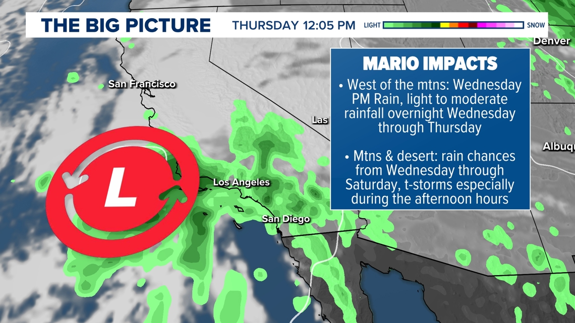
We could see scattered showers and thunderstorms as soon as Wednesday afternoon as tropical moisture associated with Mario moves in across Southern California.
SAN DIEGO — San Diego County weather will transition from hot highs to high humidity with a slip in temperatures as clouds start to build across San Diego County. Tropical Cyclone Mario made the transition from a Tropical Storm on Tuesday morning to a Tropical Depression on Tuesday afternoon.
The system will continue to weaken as it nears Southern California off the Pacific Ocean due to cooler ocean water. It looks to be a post-tropical system over the next 24 hours. This will lead to an influx of tropical moisture with higher humidity and chances for scattered showers and thunderstorms countywide. The activity could start as soon as Wednesday afternoon/evening, with the bulk of the moisture slated to impact San Diego County Wednesday night through Thursday.
THURSDAY: WEATHER IMPACT ALERT DAY
With rain in the forecast, slick roads will be a hazard, naturally. Light to moderate rainfall could also lead to street flooding. Suggested rainfall totals are 0.25″ to 0.50″, west of the mountains, and 0.50″ to 1.00″ possible for the mountains and the desert. Please use caution out on the roads!
With a chance for thunderstorms in the forecast, especially in the afternoon and evening hours, we could see stronger cells capable of heavy rain, small hail, gusty winds and lightning.
WEEKEND FORECAST
We could still see isolated showers and thunderstorms on Friday, west of the mountains, before those chances are more focused on the mountains and desert on Saturday. The entire county will dry out on Sunday with chances for wet weather wrapping up.
High pressure will bring us more toasty temperatures over the weekend and through the start of next week as we say hello to Fall.
Rain and storm chances increase as moisture from Tropical Storm Mario filters into the area. ⚠️🌧ꈨ Take caution as you make your commute to and from work as roads may become slick from rain🚘💥🚗. pic.twitter.com/IT7GXplets
— NWS San Diego (@NWSSanDiego) September 16, 2025