DALLAS – North Texans are waking up to clear skies Thursday, Oct. 5, though we expect a gradual increase in humidity and cloud cover throughout the week, with temperatures remaining unseasonably warm.
Cold Front
A weak area of low pressure currently impacting Louisiana is set to move onshore across South Texas by Friday. While it won’t directly affect North Texas weather patterns significantly, it will usher in higher humidity and additional clouds.
We will likely see a few additional cumulus clouds bubble up through the heat of pretty much it now. There is a weak area of low pressure that’s spinning showers up onshore across Louisiana, and that weak area of low pressure will actually move onshore across South Texas tomorrow. It doesn’t do much for us here, but it will allow for an increase in humidity.
Today’s Forecast
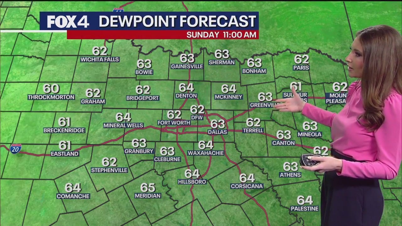
Morning temperatures across the immediate Metroplex hovered in the upper 60s to about 70 degrees, accompanied by light winds. Drier conditions were noted further east, with dew points around 60 degrees expected to dip into the mid and upper 50s this afternoon, indicating slightly more moisture in the air compared to Wednesday.
High temperatures are anticipated to stay just shy of 90 degrees, with light south-southeast winds and abundant sunshine, broken only by a few extra clouds in the afternoon.
Weather This Week
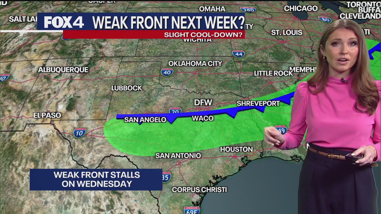
Looking ahead, a weak cold front is expected to approach North Texas on Tuesday and Wednesday. While it’s a “cold front,” it will have minimal impact on high temperatures. This front could bring isolated showers, with a 10 percent to 20 percent chance of rain Tuesday and Wednesday. Most of North Texas is expected to remain dry.
By Monday afternoon, with the return of higher moisture in the atmosphere, we will likely see a few extra clouds, but it won’t prevent our high temperatures from climbing back to around 88–89 degrees. Even after that weak front drops in, we could squeeze out a stray shower, maybe 10 to 20 percent coverage Tuesday and Wednesday. Very isolated in nature.
A brief dip in temperatures is possible midweek, but a ridge of high pressure is projected to return and strengthen by the end of next week and into the weekend. This will push high temperatures back toward 90 degrees.
The seven-day forecast indicates a quiet weather pattern overall, with unseasonably warm conditions persisting and only a slight chance of showers mid-week.
7-Day Forecast 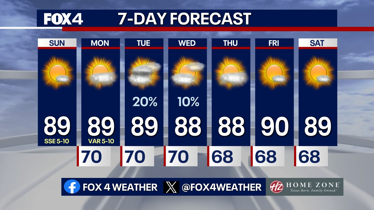
The Source: Information in this article is from the FOX 4 Weather Team.