The Brief
-
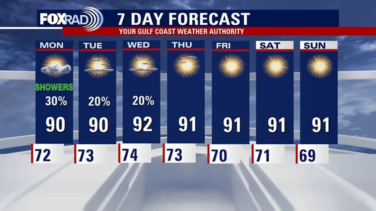
Highs Remain in the Low 90s
-
Slight Rain Chances Start the Work Week
-
Disturbance Brewing in Atlantic
HOUSTON – Prepare for temperatures to remain warm for October for all your outdoor plans this week.
More warm temperatures, watching increase in moisture
Monday will be another above average day with highs in the low 90s for southeast Texas.
Prepare for temperatures to remain warm for October for all your outdoor plans this week. Rain chances are slim.
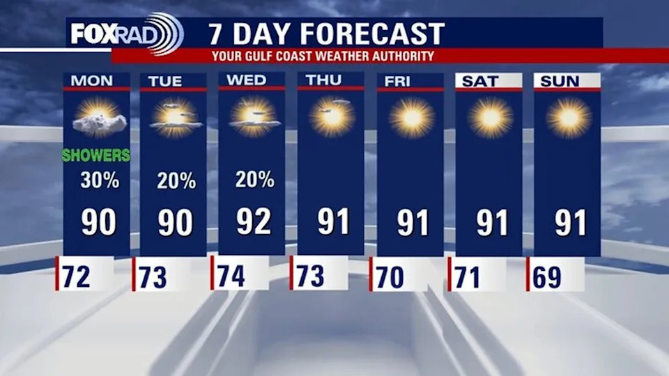
Look for a few showers Sunday evening and a few storms overnight through Monday. Isolated chances for rain stay in the forecast for Tuesday and Wednesday.
Dry conditions leading to minor drought
Drought conditions are developing state and areawide, communities west of Houston are finding themselves in moderate drought conditions.
Houston proper is not yet in a drought, but it is dry.
Dry vegetation is leading to an increased risk for brushfires, so be very cautious with any outdoor burning until conditions change. Lower humidity values also lead to an increase in fire danger.
In the tropics
The National Hurricane Center continues to monitor an area of low pressure over the northern Gulf, this area will likely NOT develop due to strong upper-level winds. It is however producing showers and thunderstorms off the coasts of Louisiana, Mississippi, and Alabama.
In the distant Atlantic, there will likely be a depression or tropical storm forming next week. This formation is thousands of miles away and the long-term path is uncertain.
The next name on the list is Jerry.
The Source
Your Gulf Coast Weather Authority