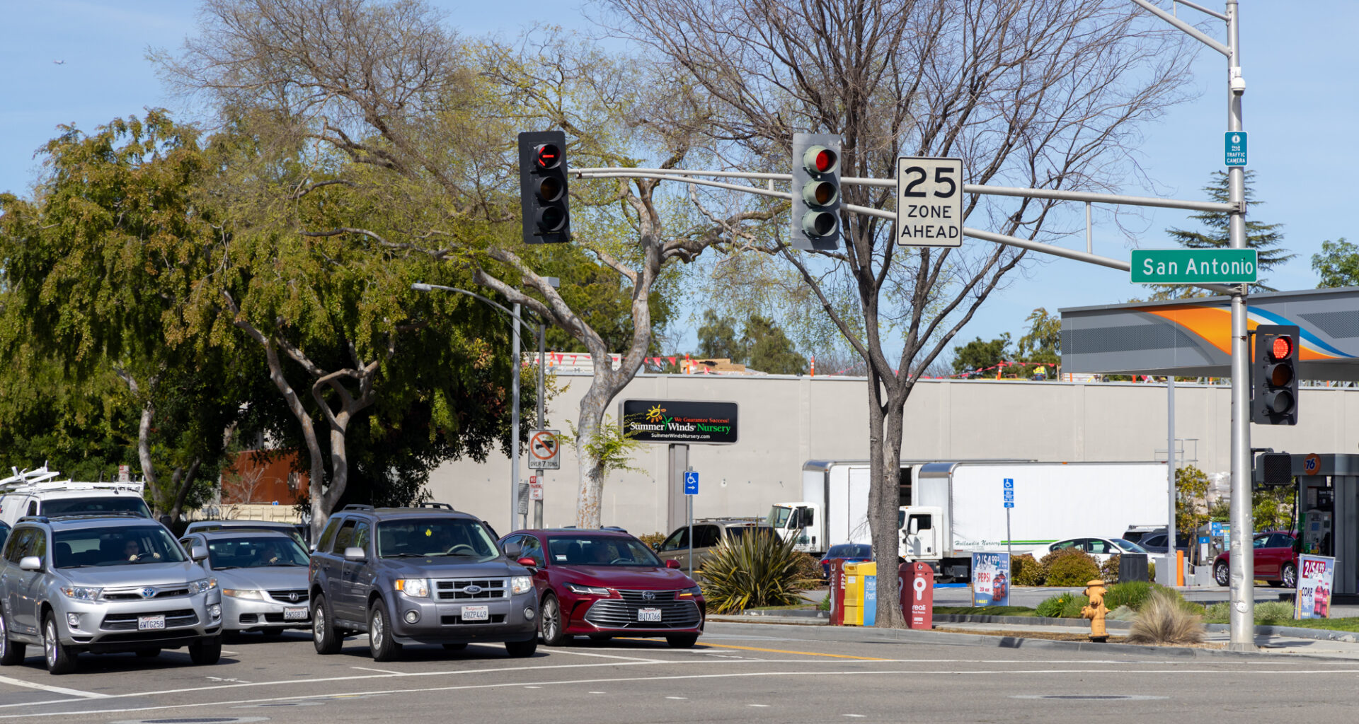
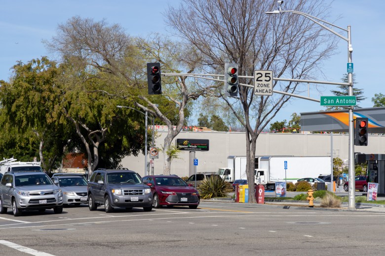
 San Antonio Road in Palo Alto on March 13, 2024. Photo by Devin Roberts.
Palo Alto leaders appear to be optimistic about the opportunities to transform the industrial area around San Antonio Road into an idyllic residential neighborhood, but they indicated Monday that they are far less enthusiastic about increasing office development through that process.
City staff and a consultant with Raimi and Associates sought feedback from the City Council on Monday night about the recently completed Existing Conditions Analysis for the San Antonio Road Area Plan, which aims to add more than 1,500 housing units on a stretch of San Antonio between Alma Street and U.S. Highway 101.
The September report summarizes a variety of factors that currently impact the area plan, such as land use, housing stock, transportation options, public facilities and more. Staff and consultants were also hoping to get direction from the council about initial aspects of the area plan, including denser mid-rise housing, increased office development and mobility improvements to connect the area to Palo Alto’s extensive bike and pedestrian network.
Senior planner Robert Cain told the council that the project will proceed at a “very quick pace,” and that staff aim to present land use and mobility alternatives by June of next year and complete the plan by 2028. A key priority is connecting residents across the San Antonio corridor, which is already heavy with traffic and hazardous for pedestrians and cyclists.
“It will be a necessity to the future success of this plan to create a safe place for pedestrians and bikes,” Cain told the council. “This includes creating new facilities along San Antonio to better connect to Caltrain and retail amenities at the San Antonio shopping center and improving crossings of San Antonio to connect to schools, community facilities and other retail amenities.”
Those goals build upon findings from the Existing Conditions Analysis, which states that this section of San Antonio Road contains about 2.7% of the city’s housing but 5% of fatal or serious traffic collisions.
Council members urged staff to make bike and pedestrian connectivity a priority throughout the planning process, especially when it comes to the schools and children in the area. Council member Julie Lythcott-Haims specifically emphasized the fact that many school children live in Palo Alto but are enrolled in Los Altos or Mountain View schools.
Increasing the housing development via the San Antonio Road Area Plan would bring additional children needing to cross the busy and dangerous intersections in the neighborhood, she added.
“This is such an opportunity to show how a modern city, Palo Alto, adapts to the housing challenge, the climate challenge, the sustainability challenge, the loneliness challenge, the other health and wellness issues our community faces, and to say, ‘Maybe we are creating that 15-minute walkable city or neighborhood,’” Lythcott-Haims said.
Like with school districts, residents of the plan area frequently shop and work in neighboring cities and vice versa.
“The borders do not really segregate our communities. They’re boundaries of jurisdictions, but they’re not boundaries of urban planning and how people move,” Burt said.
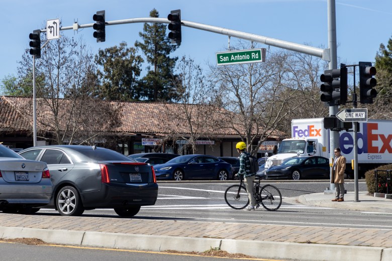 San Antonio Road, shown here on March 13, 2024, goes through Palo Alto, Mountain View and Los Altos. Photo by Devin Roberts.
Cain, the senior planner for the project, described the changes coming to the area in broad strokes as a transformation from industrial to commercial mixed-use — which includes initial plans for additional office development.
But this office proposal was a sticking point for many members of the council.
Both Burt and Council member Keith Reckdahl cited the existing jobs-housing imbalance in the area, which causes long commutes due to a housing shortage in areas where people work. For example, Burt said Mountain View has recently exacerbated that issue within its city limits, and he was concerned that developing additional office space as part of the San Antonio Road Area Plan would bring those problems across the border to Palo Alto.
“I really want to discourage office,” Reckdahl added. “We don’t have that much developable land, and we really want to make progress on our jobs-housing imbalance at this spot. We just don’t want to tread water, because if we tread water at this spot, we don’t have a lot of other spots to make up for that.”
While the jobs-housing imbalance has been an issue of concern in Palo Alto for decades, the council is now dealing with a more acute symptom of its housing crisis: the rapidly growing number of RVs parked on city streets. A recent point-in-time count performed by Santa Clara County showed that the homeless population doubled over the past two years, with the vast majority of the homeless individuals living in vehicles.
Vice Mayor Vicki Veenker, who at this meeting was filling in as mayor for the absent Ed Lauing, expressed hope that the plan would be able to offer solutions to the growing RV homelessness that disproportionately affects the San Antonio area. The City Council plans to take up the broader issue of enforcing RV parking and towing at its Oct. 20 meeting.
Planning Director Jonathan Lait also discussed the potential impacts of Senate Bill 79, which at the time of publication awaits signature on the governor’s desk. The bill would greatly increase building height and density limits near public transportation sites — and for the San Antonio Road Area Plan, the relevant site is the nearby Caltrain station. Citing the ever-changing nature of state law, Lait said California remains “tilted toward the developer at this point.”
He also said city staff are about to solicit feedback from the community next, with a workshop at Cubberley Community Center on Oct. 23 and an online survey throughout the month available on the city’s website.
“San Antonio is already a concrete jungle, but if we’re reimagining it, I think there’s a lot of exciting opportunities there to make it really liveable,” said Council member Greer Stone.
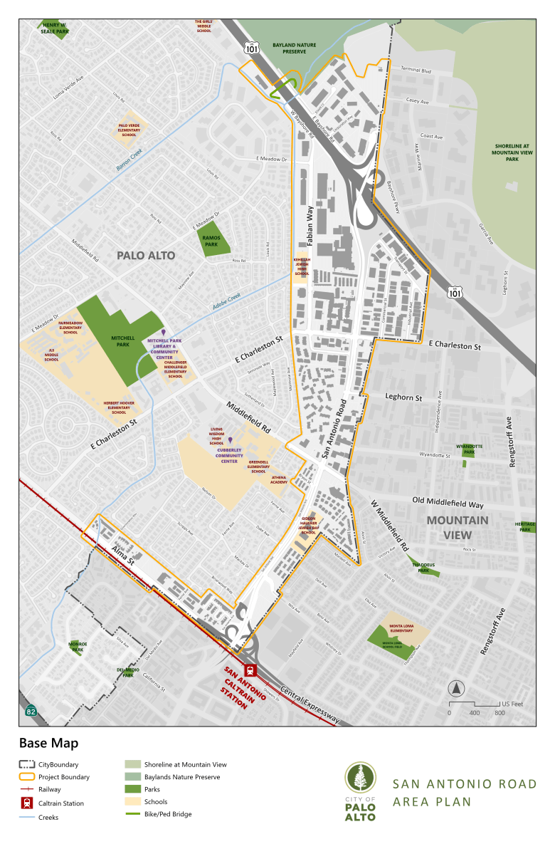 This map shows the boundaries of the San Antonio Road planning area. Courtesy city of Palo Alto
Most Popular