
SAN DIEGO, CA — After several days of summer-like weather, a cold storm system is on the way that’s expected to wallop Southern California with widespread, heavy rain.
While the weather will stay hot Monday, a cooling trend is expected to start Tuesday ahead of an autumn storm that is predicted to bring low temperatures, heavy rain and mountain snow, according to the National Weather Service. Forecasters said the storm could deliver the heaviest and most widespread precipitation to the region so far this season.
“There’s still some question about the amount of rain and its exact timing, with the computerized models that predict future weather presenting a range of possibilities,” The New York Times reported. “Forecasters said the most likely outcome pointed to beneficial rainfall that would moisten the landscape and lower wildfire risk, while there was a small chance for hazardous rainfall, particularly in Southern California.”
Rain may start as early as Wednesday night, but the heaviest rainfall is likely to take place Thursday morning into Thursday night in Southern California, according to the National Weather Service.
Forecasters predict rain totals between one and two inches across the coasts and valleys, with foothill areas and mountains possibly receiving between two and four inches. Weather officials said there’s a 30% chance for higher totals than what is forecast.
“Regardless of the start time, the models do suggest that the front moving through will bring a heavy, but relatively short period of rain, falling within about 5-10 hours,” National Weather Service Los Angeles forecasters wrote.
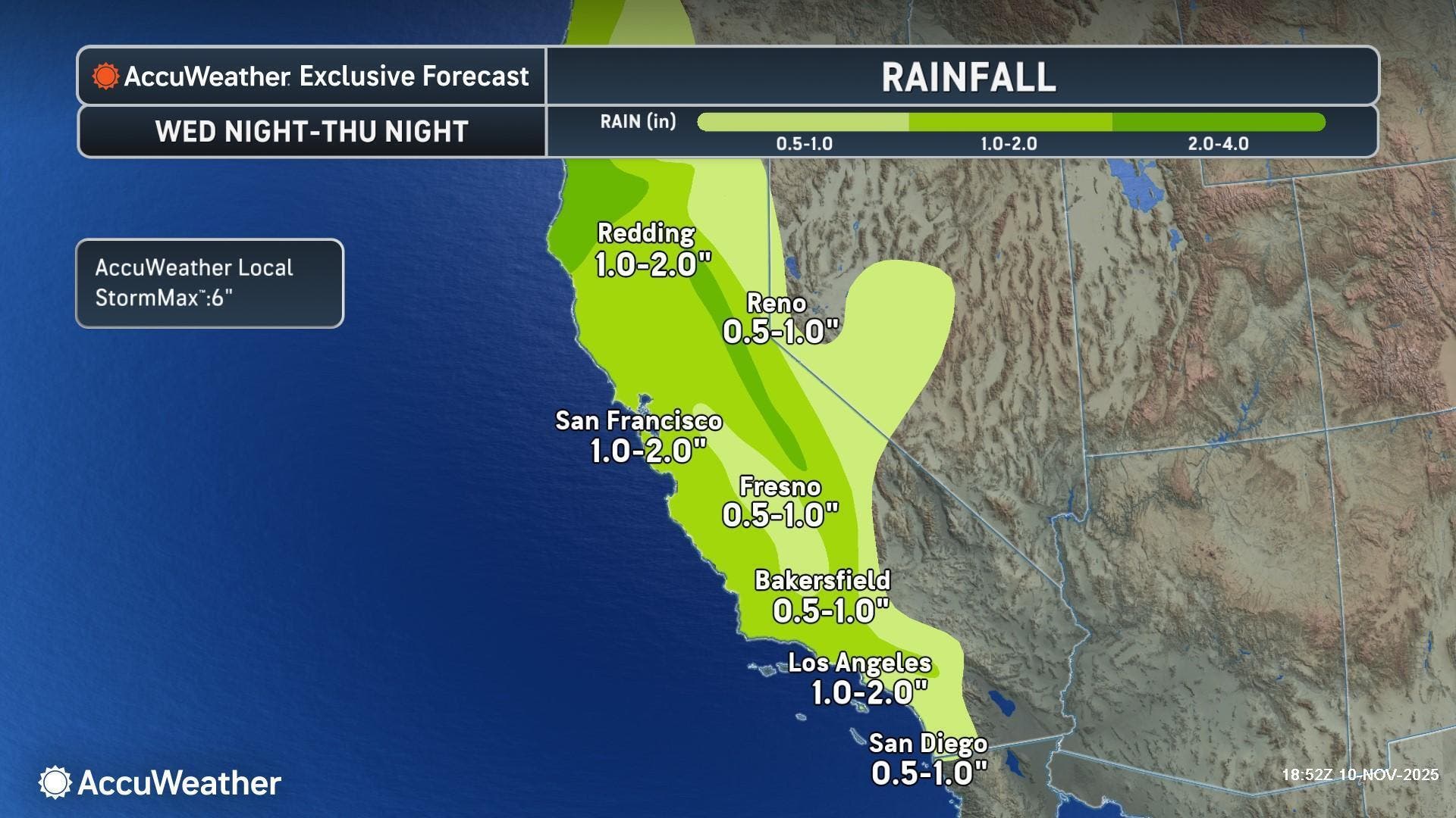 Forecasters predict rain totals between one and two inches across the coasts and valleys, with foothill areas and mountains possibly receiving between two and four inches. Credit: AccuWeather
Snow levels will likely remain at or above 8,000 feet for most of the storm, then drop to around 6,000 feet as the last of the rain moves through Thursday night into Friday morning, according to the weather service. Forecasters said it currently does not appear to be cold enough for snow on the Grapevine, but some light accumulations — two to four inches — are possible at 6,000 feet.
“Travelers should monitor the latest conditions and be prepared for snow-covered roads and possible closures,” AccuWeather Senior Meteorologist Heather Zehr said.
The storm comes after a stretch of warm temperatures over the past several days.
In fact, two calendar day high temperature records were set Sunday across southwestern California, according to the National Weather Service.
Paso Robles Airport reached 90 degrees, which tied the old record of 90 degrees recorded in 1956. Woodland Hills reached 97 degrees, which tied the old record of 94 degrees set in 1956.
2 calendar day high temperature records were set today across Southwestern CA! #CAwx Paso Robles Airport reached 90 degrees. This ties the old record of 90 degrees set in 1956. Woodland Hills reached 97 degrees. This ties the old record of 94 degrees set in 1956. pic.twitter.com/2WAgod5ARH
— NWS Los Angeles (@NWSLosAngeles) November 10, 2025
Warm temperatures will linger along the West Coast states until the storm arrives.
Here’s a look at forecasted high temperatures across Southern California:
Dry but cool weather is expected over the weekend, according to the National Weather Service. A second storm is on track to arrive early next week, but forecasters currently expect it to bring less precipitation.
“Additionally, looking out ahead to early next week, another storm could be on the tails of the one at the end of this week,” the weather service said. “However, early model projections at this time, do show the storm would be lighter.”