 article
DALLAS – Dallas-Fort Worth is in for some wet changes after a record-breaking hot week.
Record-breaking heat 
The week began with a new daily record high of 87 degrees on Tuesday at DFW Airport, breaking the previous record of 83 degrees. The average high temperature for this time of year is 66 degrees, according to the National Weather Service.
Wednesday Weather: Marginal severe weather risks 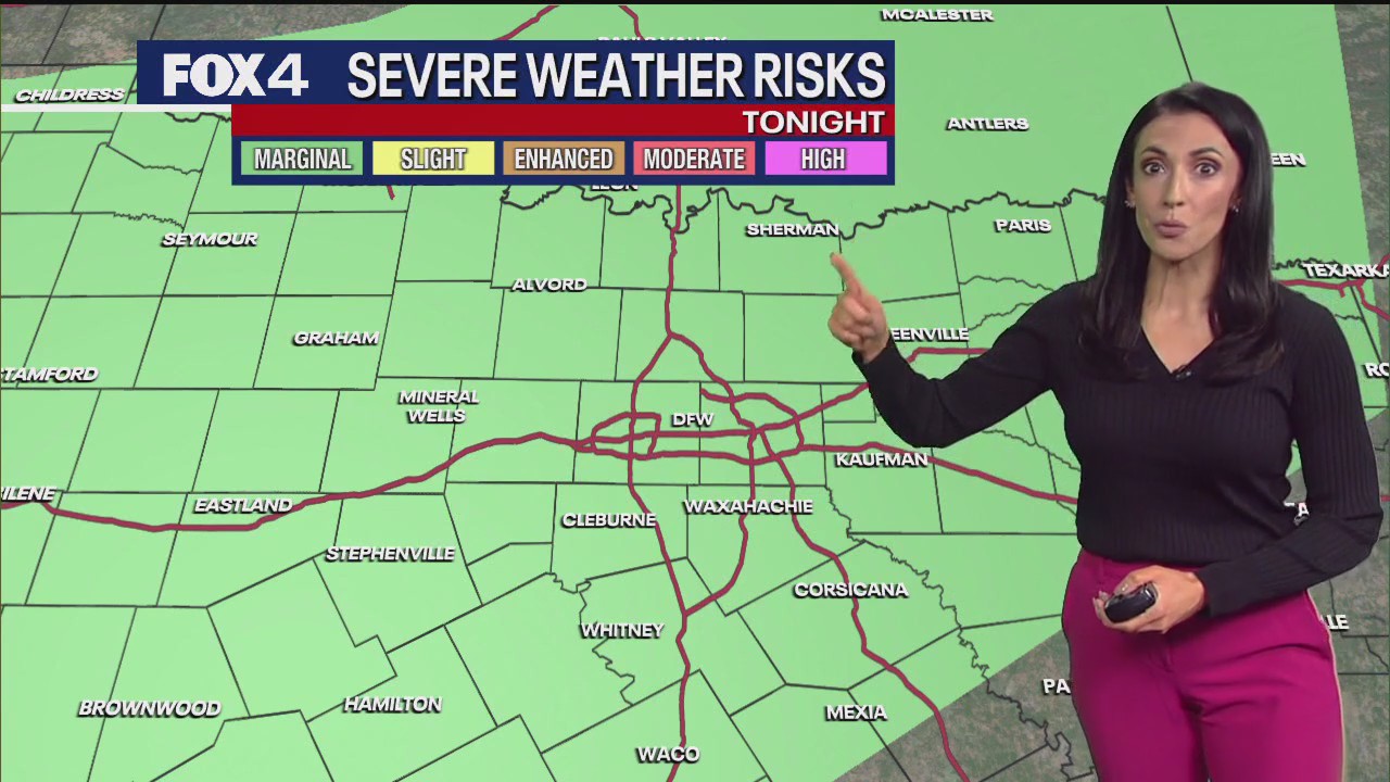
It will feel muggy Wednesday with temperatures in the 80s by the afternoon.
A low chance of rain returns this afternoon, beginning after noon. Coverage will increase to about 50% as showers move in tonight.
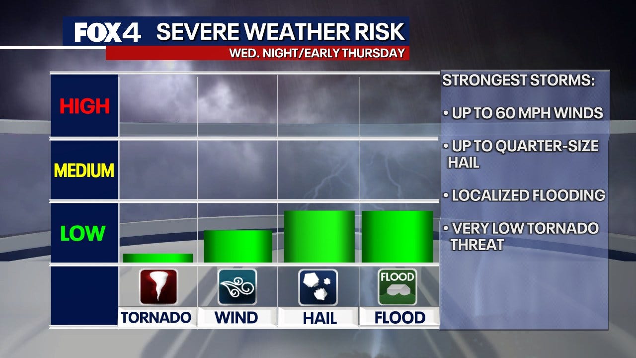
There is a marginal risk for severe storms Wednesday night. These storms will not be widespread, so only a couple of areas could be affected. The severe threats include winds up to 60 mph, hail up to the size of a quarter, localized flooding, and a very low tornado threat. These threats are mainly northwest of the Metroplex.
Overall, most areas in North Texas will see heavy rain. Storms will become widespread this evening and persist through the night, especially west of Interstate 35, according to NWS.
7-Day Forecast: More rain! 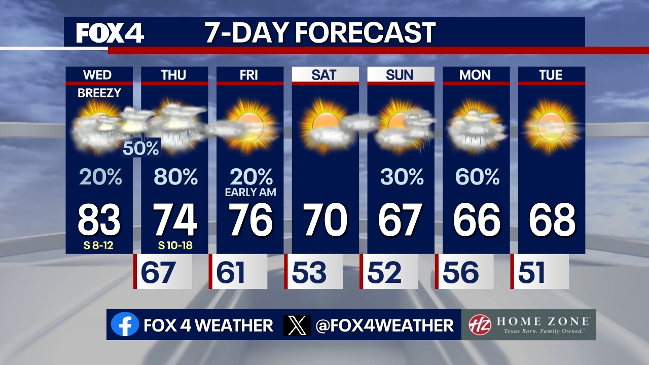
Thursday morning will be quieter as we wait for storms to approach Thursday afternoon and evening. Expect more heavy rain and gusty storms. The strongest storms are expected Wednesday night and into Thursday morning.
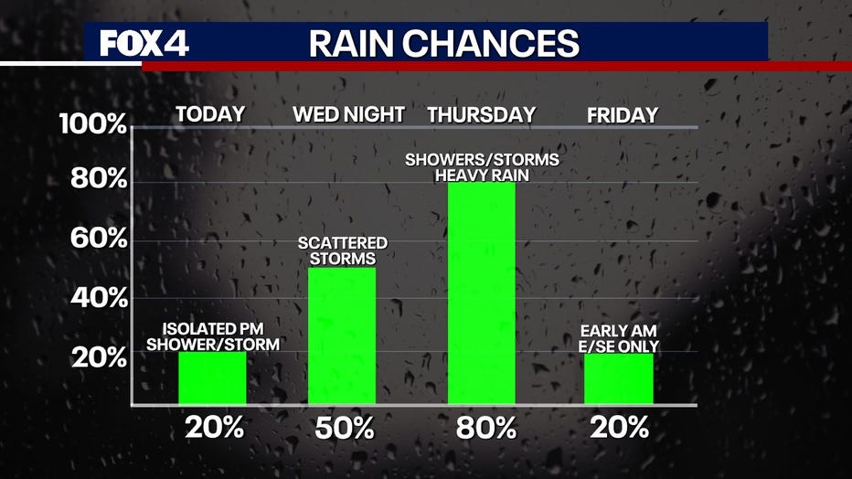
The area will then dry out, and Friday looks clearer. The day will start with some clouds but finish with sunshine, with a high of 76 degrees.
Increasing clouds move in Saturday before a fast-moving disturbance arrives Sunday, bringing more rain chances.
LIVE Radar: Dallas-Fort Worth 
The Source: Information in this article comes from the National Weather Service.