SEGUIN, Texas – In mere moments, residents from McQueeney to Seguin found themselves under a Tornado Warning late Thursday evening. Issued at 11:13pm and set to expire at 11:45pm, it was quickly cancelled in 12 minutes and switched to a Severe Thunderstorm Warning with “tornado possible” inserted into the severe thunderstorm warning text.
CLICK HERE to track the storms with our interactive radar…
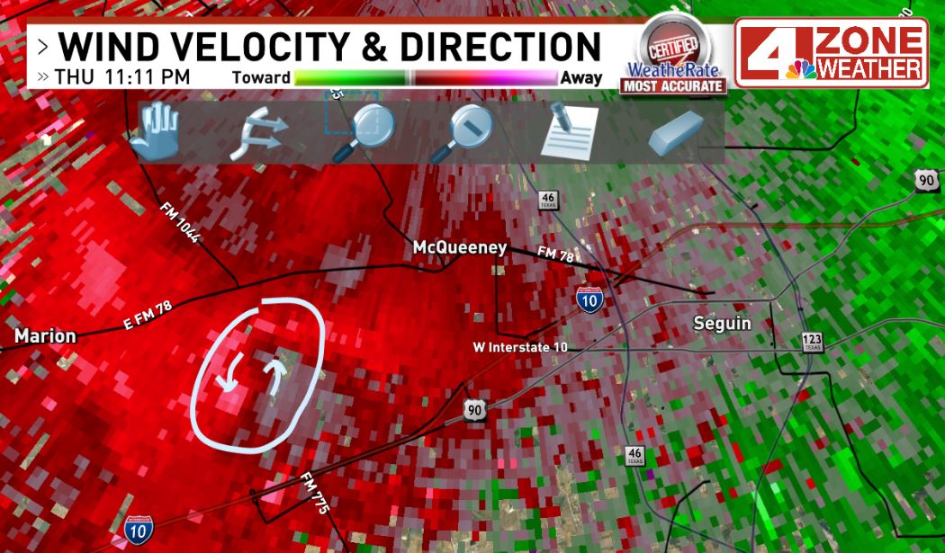
** OLD warning **{ } This was the original tornado warning issued at 11:13pm
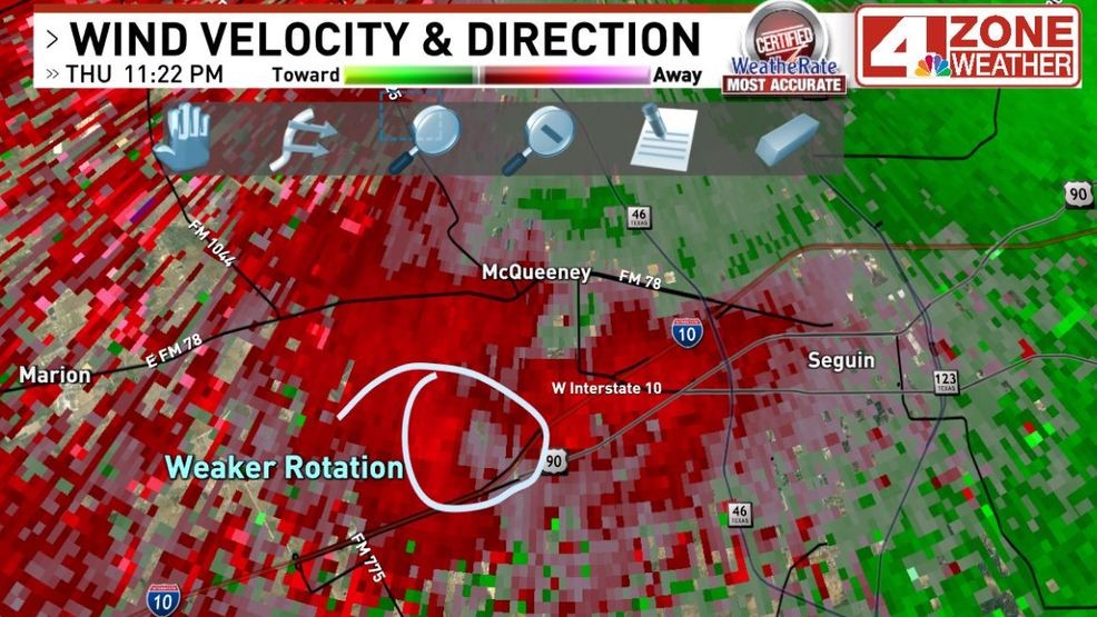
So was there a tornado? Highly doubtful based on radar data.
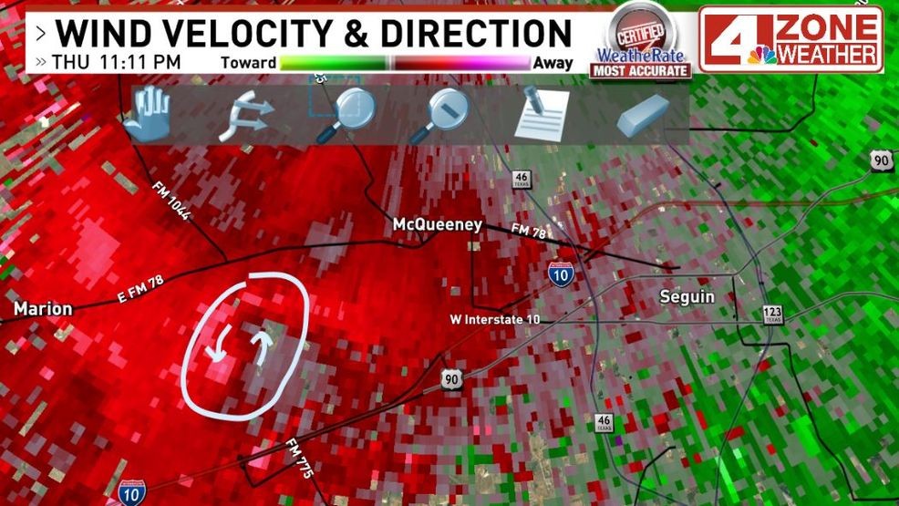
Around 11:10 to 11:11 p.m., we can see the storm starting to rotate and try to develop a tornado. The big question, would the next radar scan coming in tighten the rotation more or not. The following couple of radar scans showed it quickly weakening and broadening out.
Radar velocity data around 11:11pm as storm started to rotate southwest of McQueeney
Radar velocity data 5 to 10 minutes later shows much weaker rotation and warning was cancelled
The National Weather Service office did a nice job getting that warning out in case it did tighten and quickly produce a tornado on the ground. It’s all about early lead time with tornadoes and if they let minutes pass waiting till the next radar scan, it might have been too late with one on the ground. In this case, the storm fortunately was not able to completely tighten to produce one.
CLICK HERE to share your photos and videos…
Audrey Mason shared this video of the severe weather that hit the Swenson Heights subdivision off of Cordova late Thursday night in Seguin.
“I’m not sure if this was the tornado or not from last night, or if it was a giant microburst,” she told us. “But it wiped out all our decorations.”
News 4 Chief Meteorologist Chris Suchan was doing Facebook Live on our station page for residents in Guadalupe County, tracking the storm as the warning then expired and changed to a severe thunderstorm warning.
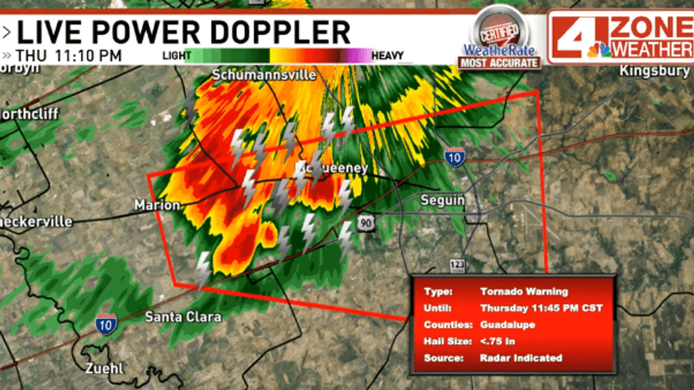
It did have around 1″ hail for a brief time west side of Seguin to McQueeney and did have gusts to 50mph or higher for a short amount of time. It also dropped heavy rainfall with small hail at times mixed in as it moved through Seguin.
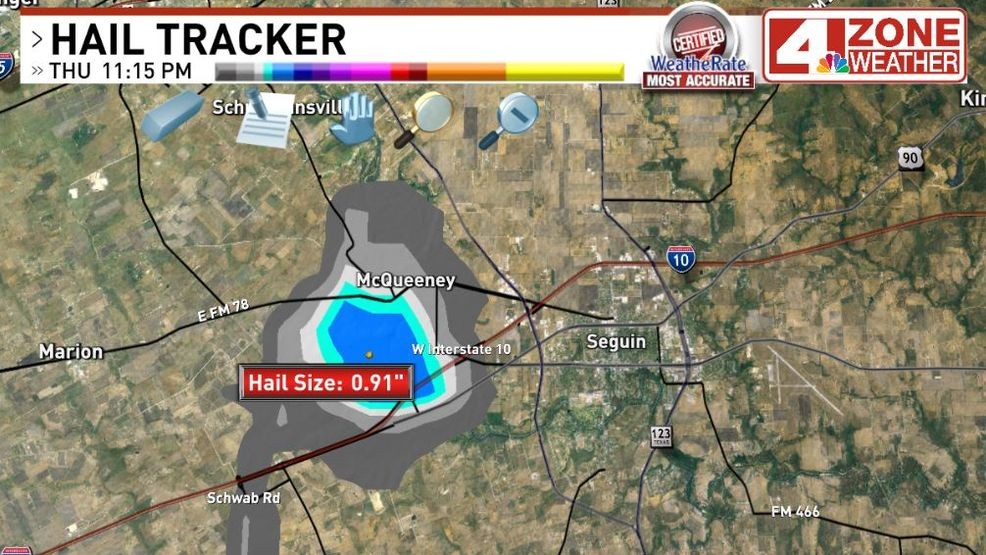
Hail was near quarter size when warning was issued as storm pulsed up with rotating updraft
This storm has completely weakened and there is no severe risk. Later tonight into Friday morning, may see some scattered showers in the area including an isolated thunderstorm.
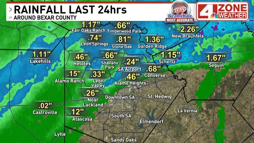
Storm dropped heavy rain from Windcrest, Schertz, Cibolo, Marion into Seguin
Comment with Bubbles
BE THE FIRST TO COMMENT
CLICK HERE to share your photos and video – or use the form below.