 Hot weather safety tips
-
Drink plenty of water. Avoid caffeine and alcohol, which can be dehydrating.
-
Avoid direct sunlight, especially during peak hours and when the UV rating is high.
-
Wear lightweight, loose-fitting clothing.
-
Use air conditioning when possible. If you do not have access to air conditioning, consider visiting a cooling centre, a shopping centre, or a public library.
-
Check on elderly relatives and other vulnerable neighbours.
-
Avoid strenuous activities during the hottest parts of the day.
-
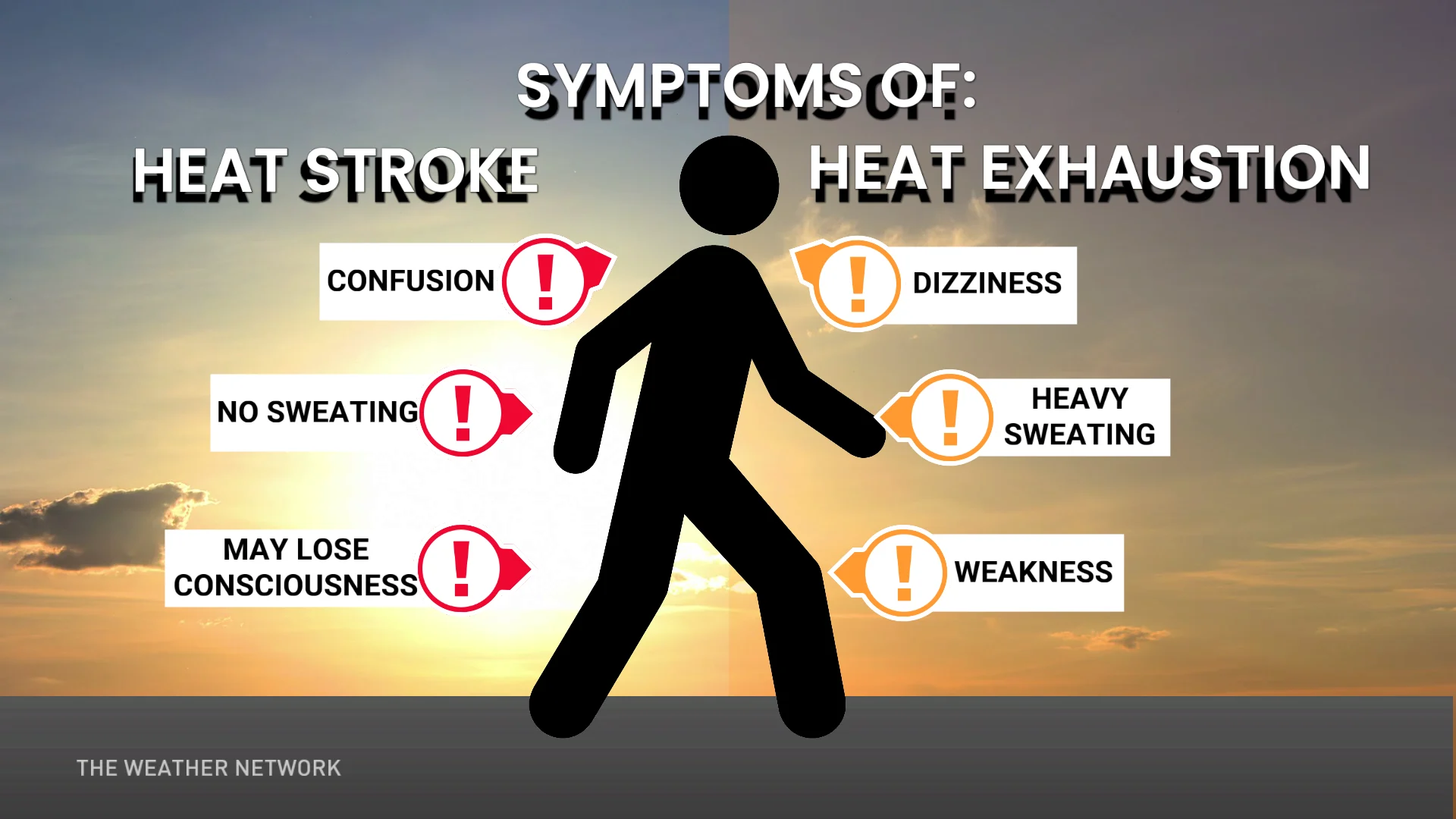
If you experience symptoms of heat-related illnesses like dizziness, nausea, or confusion, seek medical attention.
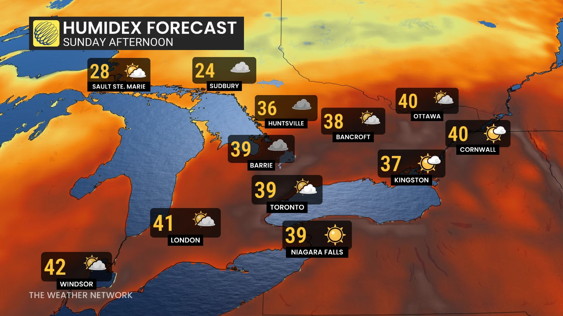
Thunderstorm risk builds with the heat
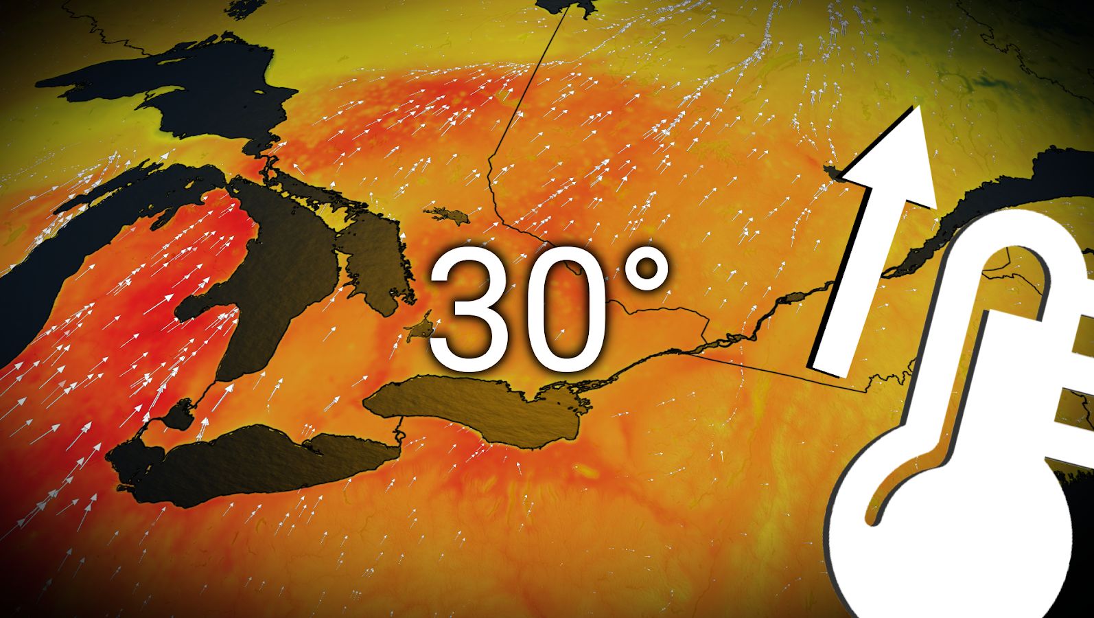
Daytime heating and high humidity will fuel the instability needed for a risk for thunderstorms on Saturday afternoon.
JULY OUTLOOK: The heat is on! Where will Canada sizzle the most in July?
A cold front pushing into southern Ontario on Sunday could trigger severe thunderstorms across the region.
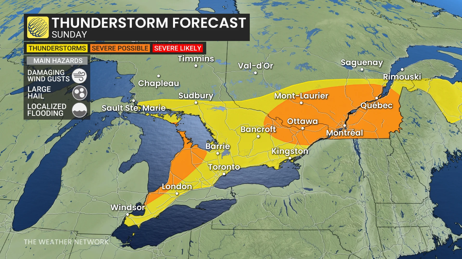
The exact location and strength of these storms is still uncertain—but given the instability and the arrival of the front, the severe potential will exist around the shorelines of Lake Huron and southern Georgian Bay, as well as in eastern Ontario and western Quebec.
Hail, damaging wind gusts and heavy rain will be possible in severe storms.
Non-severe storms will be possible in southern Ontario, away from the Lake Huron shores, extending down to Windsor and across the Greater Toronto Area (GTA).
This boundary and instability will remain in place heading into Monday, as well, bringing a second round of active weather to start the work week.