
SAN ANTONIO – Our current string of warm, humid days is about to come to an end and it may do so with a few January thunderstorms in our region.
A weak front is in our area now and stalling out. It could become a trigger Friday to develop a few showers and storms as an incoming low pressure system and cold front move east into Texas.
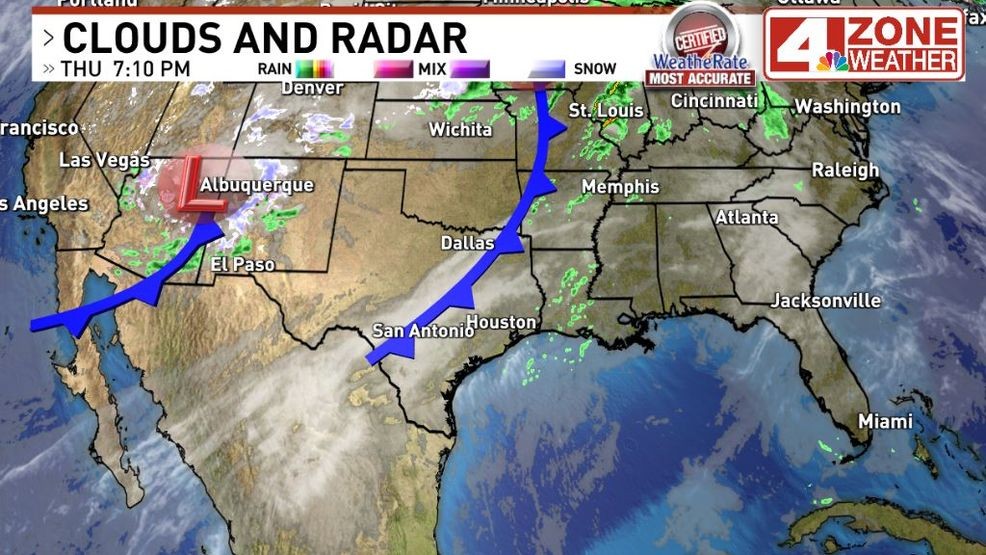
Front over us now.{ } Friday night’s cold front west of Texas
Data trends have been getting more robust on these chances compared to a couple days ago and I’ve bumped us into the “scattered” 30% rain chance category. Also of note, it’ll be very cold (around 0 to -10F) in the mid levels of the atmosphere tomorrow from 15,000 – 20,000 feet up. It’ll be very easy for any storm to produce hail given how cold it is aloft.
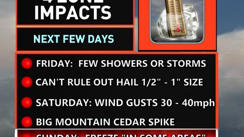
4 Zone Weather Impacts over next few days
At this time, the Storm Prediction Center (SPC) has a marginal severe storm outlook (level 1 of 5) barely touching eastern Bexar County and areas east through Lavaca County. Tonight’s brand new “Day 1” outlook update may shift this marginal outlook a bit west to include more of Bexar County and the I-35 corridor. I’ll be eagerly waiting for that update tonight.
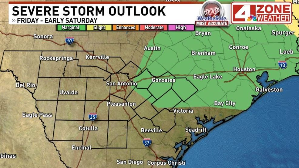
Day 2 severe storm outlook from the SPC
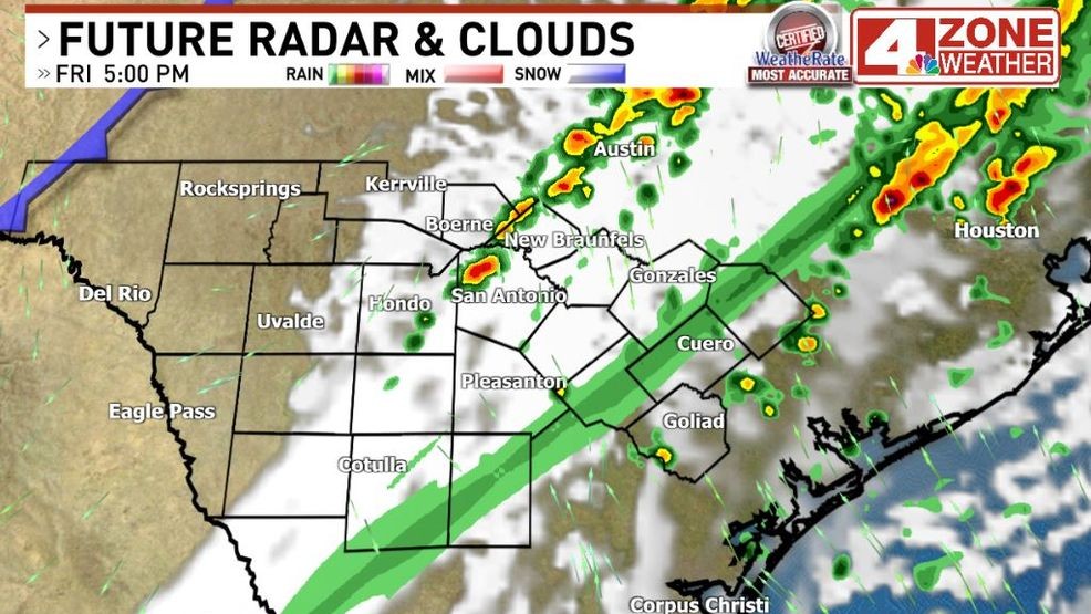
The first showers or storms will develop near or west of I-35 in the morning. They’ll move northeast after developing with the steering currents. The general zone of scattered showers and storms will shift east through the afternoon and by the evening, our eastern zone counties would have the best coverage.
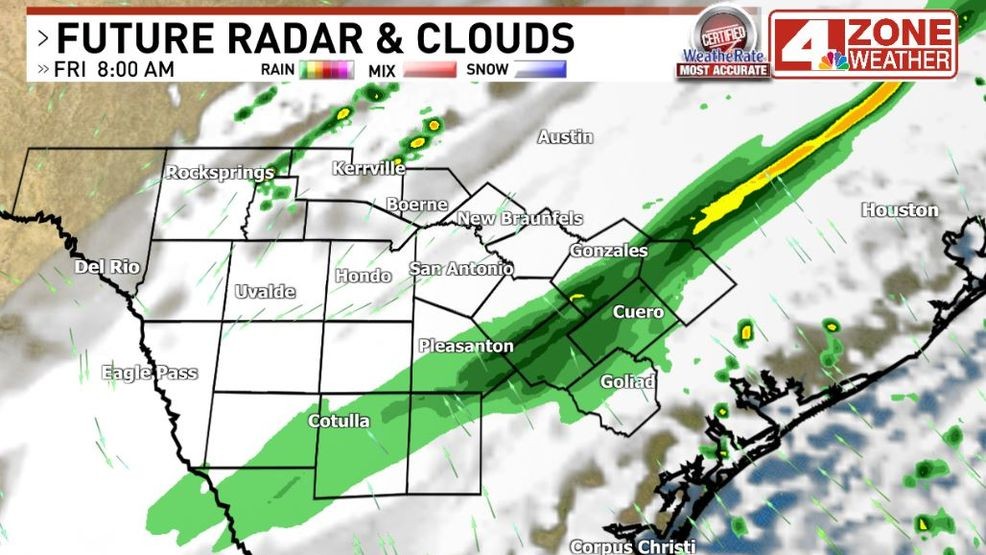
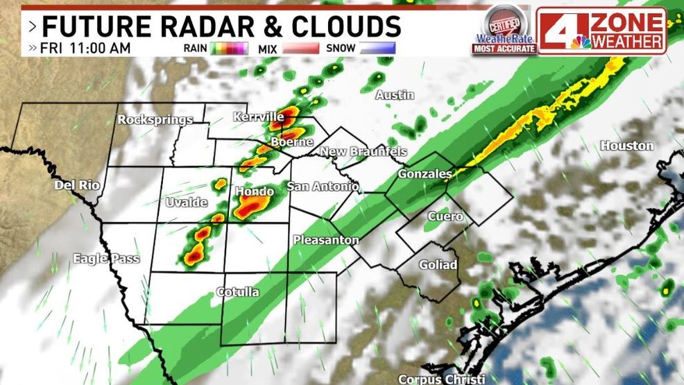
Future radar around 10 – 11AM
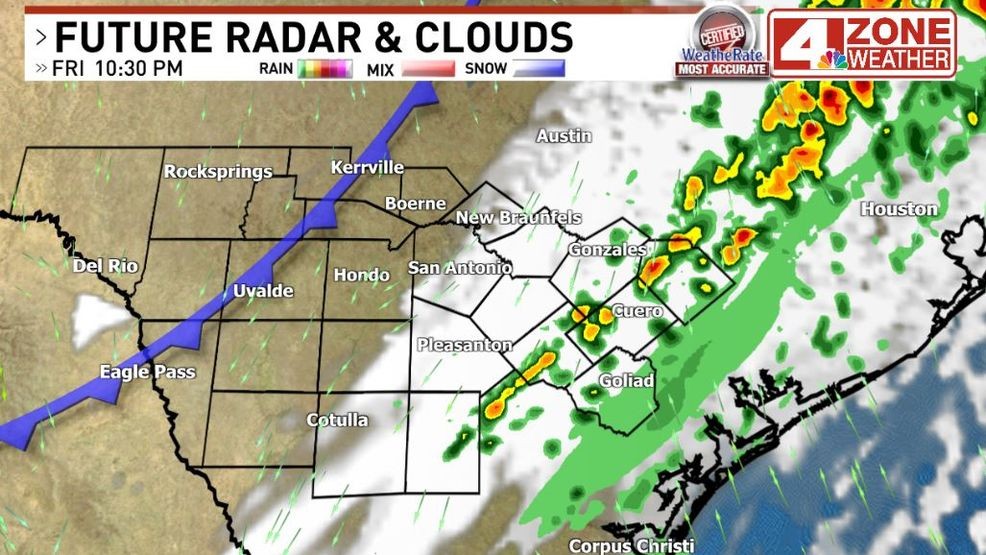
Future radar late evening
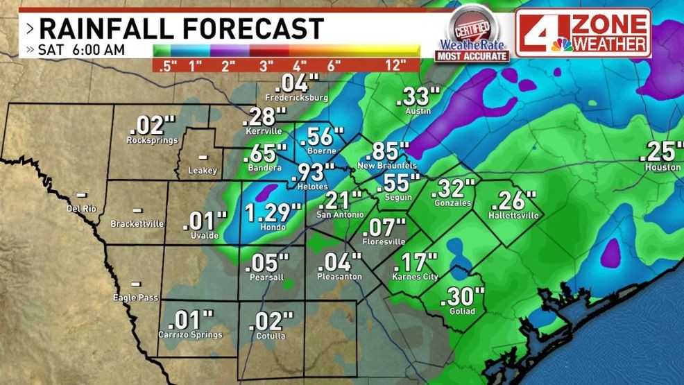
It’s important to note, many will not see rain too and feel disappointed. It’s a scattered chance and rainfall amounts could go from locally 1″ or more of rain to zero in a short distance.
 Comment with Bubbles
BE THE FIRST TO COMMENT
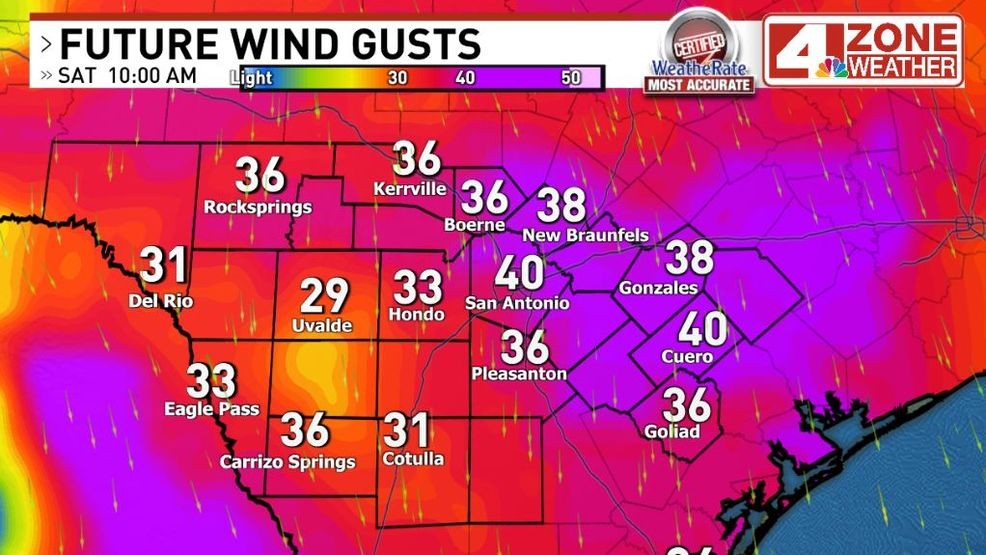
Rain chances end early Friday night with gusty winds moving in behind our next cold front. Wind gusts of 30 – 40+mph possible into Saturday. This will likely spike the Mountain Cedar pollen count too over the weekend.
Gusty winds Saturday behind cold front