Winter weather alerts remain in effect for parts of Upstate New York for accumulating snow on Saturday.
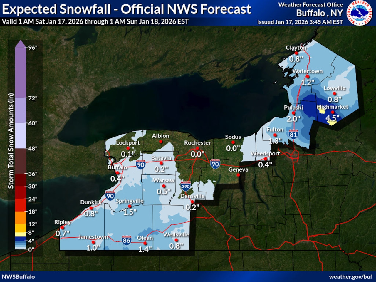
Portions of Central New York will see snow, but the Syracuse area will be mostly spared. Onondaga County is expected to receive an inch or two of snow on Saturday.
>> Related: Who got the most snow on Thursday and Friday?
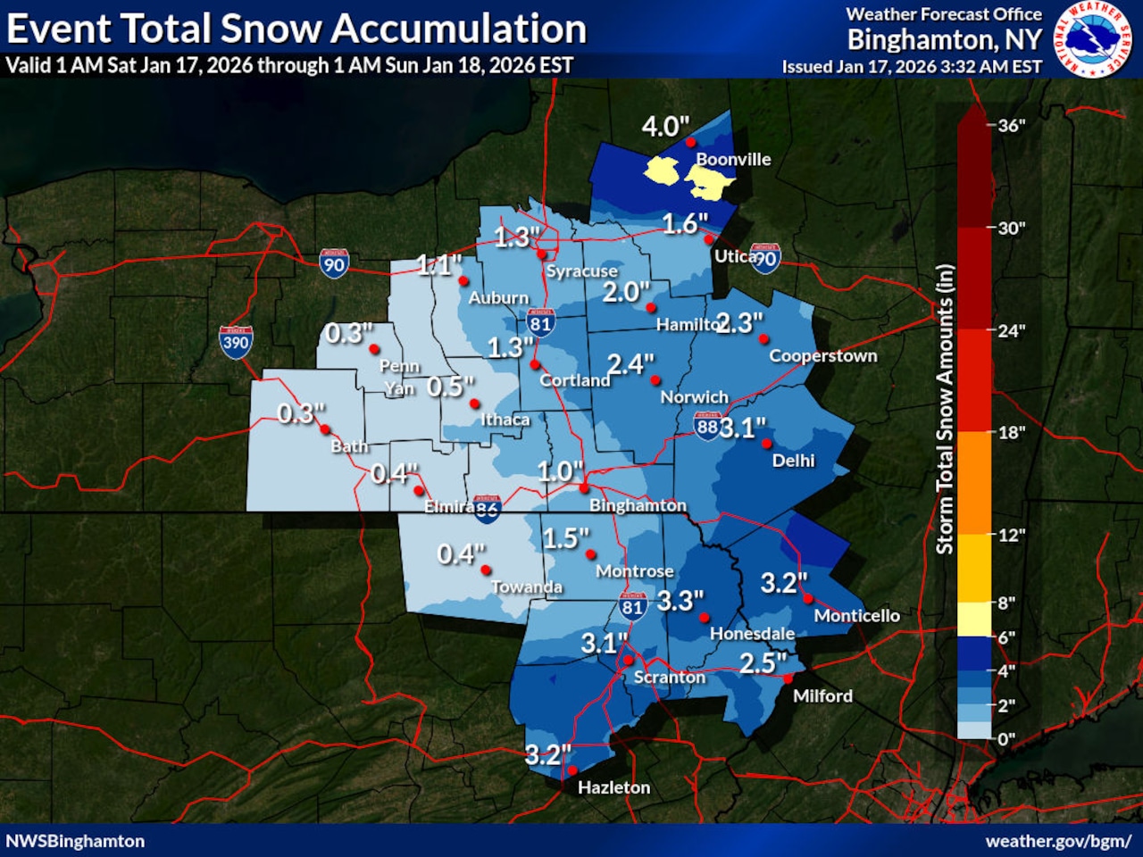
Snow began overnight across Oneida County and is expected to spread across areas along and east of Interstate 81 through Saturday afternoon before shifting eastward. The National Weather Service warns that moderate snowfall rates and banding are possible during the morning hours, with snowfall totals of 2 to 5 inches expected in the hardest-hit areas.
The snow should taper off by late afternoon, though scattered snow showers remain possible Saturday night as a cold front passes through the region. Motorists should expect slippery road conditions and reduced visibility during the heaviest snowfall periods on Saturday morning and early afternoon.
 National Weather Service
A winter storm advisory is in effect for Oswego, Jefferson and Lewis counties until Sunday at 1 a.m. Residents there should anticipate additional accumulations of 3 to 6 inches in the heaviest and most persistent part of the band, according to the weather service. The snow band will begin to slowly drift south this evening and then settle across the southern portion of Oswego County.
Much colder air will surge into Central New York early next week following the passage of several cold fronts. High temperatures on Tuesday are forecast to remain in the teens with wind chills falling below zero.
Lake effect snow showers are expected Monday through Wednesday, though the primary snow bands should remain north and west of Syracuse. A brief window of more westerly winds late Monday night into Tuesday could bring additional snow showers to the region.
 National Weather Service
Here’s what to expect in other areas of Upstate New York this weekend:
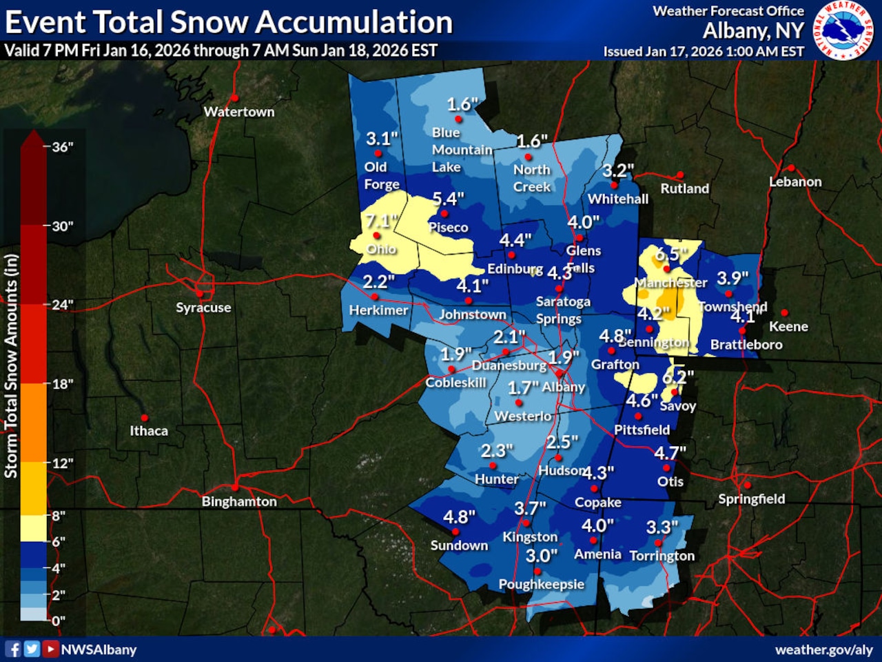
Northern Herkimer, Southern Herkimer, Southern Fulton, Northern Saratoga, Northern Warren, Northern Washington, Eastern Rensselaer, Eastern Columbia, Western Ulster, Eastern Ulster, Western Dutchess, Eastern Dutchess, Northern Fulton, Southeast Warren and Southern Washington as well as Hamilton County: Winter weather advisory in effect until 7 p.m. for accumulations between 2 and 5 inches, with locally 6 to 8 inches across the southern foothills of the Adirondacks, southern Greens and northern Berkshires.
Orange and Putnam counties: Winter weather advisory for total snow accumulations between 2 and 4 inches.
Delaware and Sullivan counties: Winter weather advisory for total snow accumulations between 2 and 5 inches.