CHICAGO – After a busy Tuesday night with flash flooding in parts of Chicago, it has been a much calmer Wednesday.
A weak lake breeze is moving inland this evening, and a few showers and storms have developed along this boundary.
While severe storms are not anticipated, these storms will be capable of torrential downpours and lightning. Isolated showers and storms will remain possible through at least sunset, and then a drying trend is expected tonight.
Chicago weather forecast
What we know:
Tonight, scattered clouds will begin to recede after sunset, bringing temps into the mid 60s. July’s only full moon, the “Buck Moon,” will be visible in the east, reaching its peak around 2 a.m. No precipitation is expected.
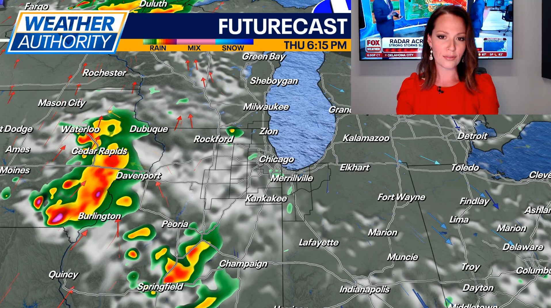
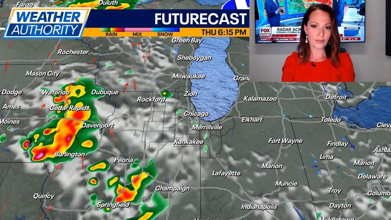
Future forecast
What’s next:
Hazardous beach conditions remain in effect through tomorrow morning, but calm and clear conditions look to take over after a cool and potentially foggy morning commute. Highs on Thursday will be in the low to mid 80s with skies becoming partly cloudy during the day.
A few stray showers or storms are possible on Friday, but most of the day will be dry with highs near 90.
The next impactful storm system will be moving in Friday evening into Saturday. Showers are storms are expected going into the upcoming weekend, and heavy downpours will be possible.
A cold front will move through the region on Saturday, possibly bringing a threat for isolated severe thunderstorms. Damaging wind gusts would be the primary concern.
Sunday brings back seasonable summer weather with temperatures in the mid to upper 80s.
Monday is expected to follow suit with mostly sunny to partly cloudy skies and highs in the upper 80s to low 90s.