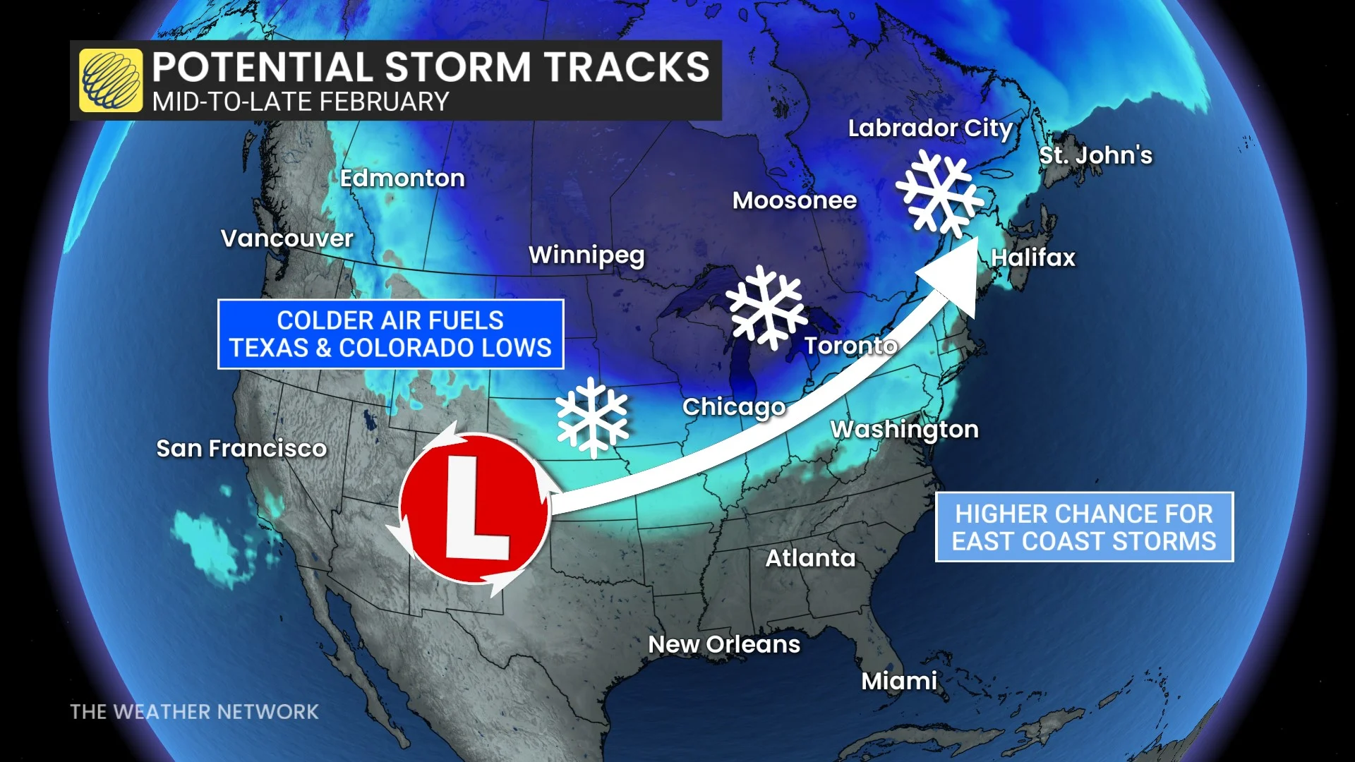
A return to colder temperatures east of the Rockies would help to build a storm track favourable for Texas and Colorado lows that could threaten the East Coast with impactful winter weather.
Folks around the Great Lakes have some good and bad news heading into February.
The good news is that a healthy increase in ice coverage across the lakes has reduced the ability for lake-effect snow to form. The bad news, however, is that we’re also losing the water’s ability to moderate frigid temperatures before they spill over southern Ontario.
February sees warming temperatures, longer days
January is historically the coldest month of the year for most communities across Canada, so the climatological depth of winter is behind us. But make no mistake: February is still a very cold month for the entire country.
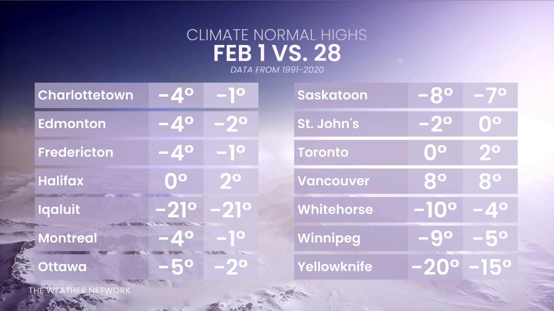
Seasonal temperatures gradually rise between the beginning and end of February. The average high in both Edmonton and Toronto rises several degrees between Feb. 1 and Feb. 28. Typical daytime highs climb a few degrees throughout the month in Winnipeg, Montreal, and Ottawa.
Days are also slowly growing longer. Toronto is on track to gain around 1 hour and 15 minutes of daylight by the final day of February. The gain is even more dramatic at higher latitudes, with Calgary set to gain nearly 1 hour and 40 minutes of daylight throughout the month.
WATCH: What does wind chill mean and how is it calculated?