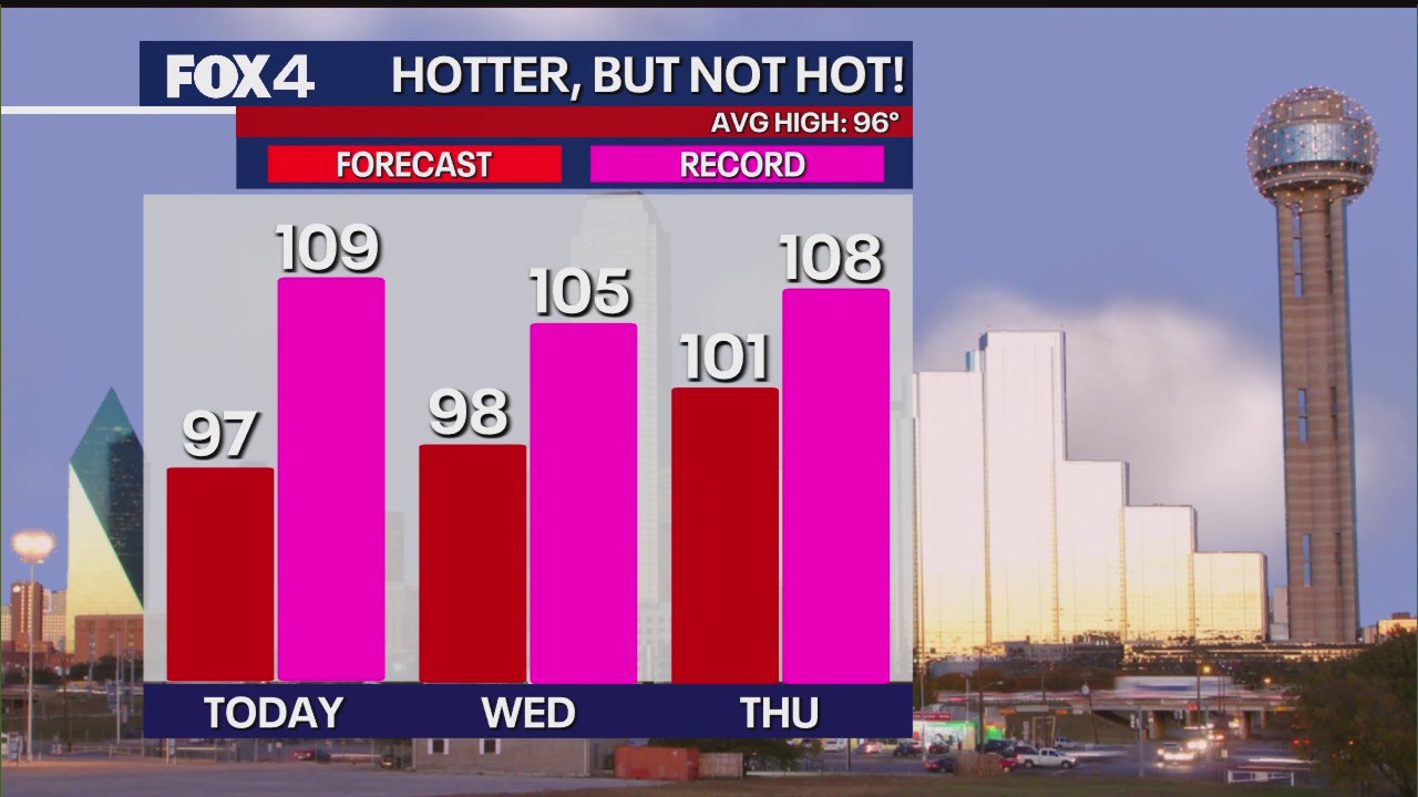
DALLAS – North Texas residents can expect a typical summer heat wave this week, with temperatures climbing into the upper 90s and reaching 101 degrees Fahrenheit by Thursday. While hot, forecasters say these temperatures remain within the normal range for late July in Texas.
Summer Heat Wave 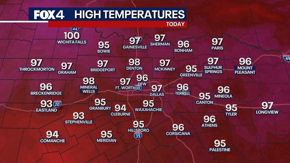
The heat is attributed to a high-pressure system slowly making its way across the state, bringing sinking, drier air. Despite the rising mercury, humidity levels are expected to be slightly lower than yesterday, with dew points in Dallas and McKinney around 71 degrees.
Timeline:
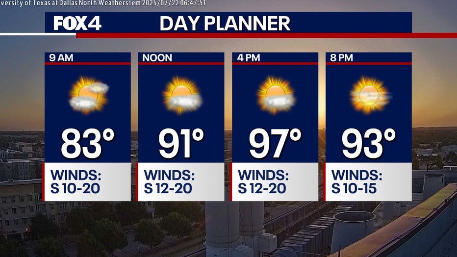
Today, expect scattered high clouds and a comfortable southern breeze. Temperatures will reach approximately 90 degrees by noon before topping out at around 97 in the afternoon.
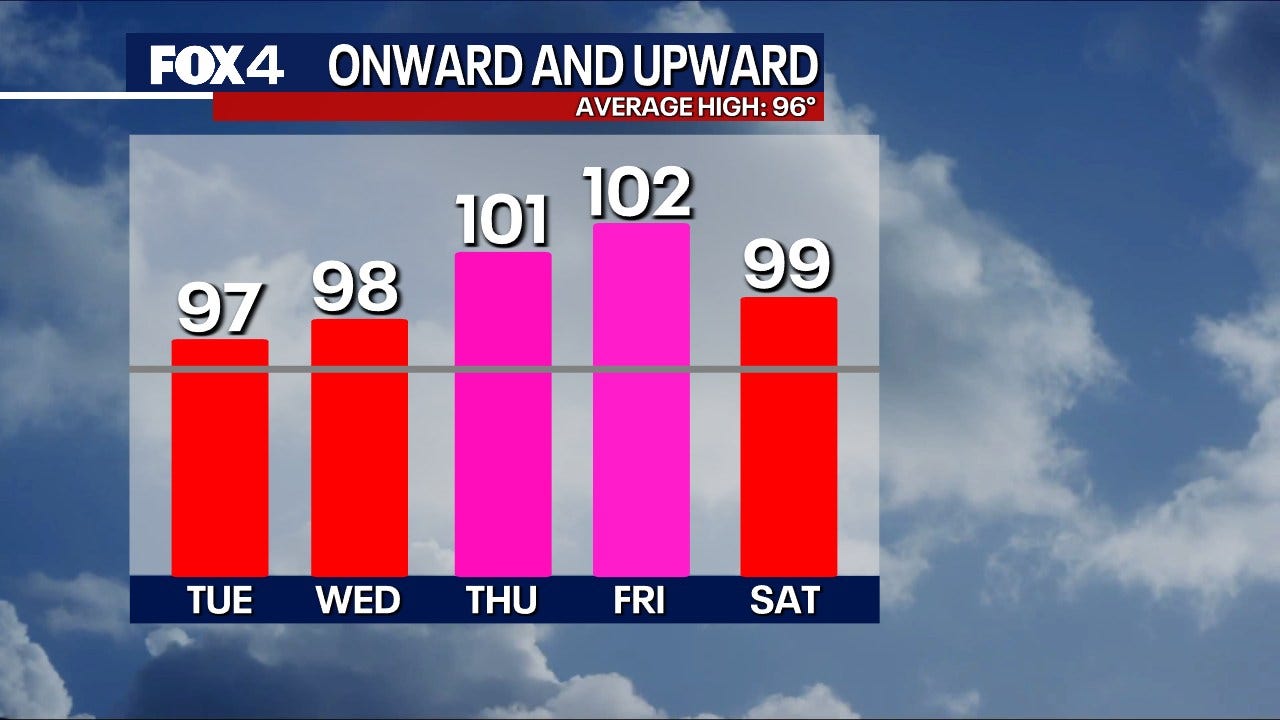
Wednesday will see mostly sunny skies as the high-pressure system begins to move eastward, allowing temperatures to inch up to 98 degrees. Thursday is forecast to be the hottest day of the week, with a high of 101 F. This heat is still well below record highs for the area.
Looking ahead, a small low-pressure system off the Florida coast is expected to drift towards South Texas by the weekend. While it is not anticipated to bring any rain to North Texas, it may introduce a few extra clouds and a slight dip in temperatures, keeping them just under 100 degrees.
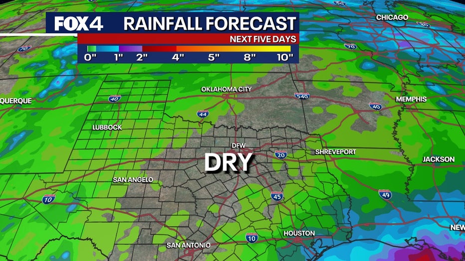
Area lakes, including Possum Kingdom, are reported to be full, a welcome sight for late July after a prolonged period of lower water levels in previous years. This comes before an anticipated dry spell.
Forecasters note there are currently no tropical systems developing in the Gulf of Mexico or Atlantic, with a 0% chance of formation in the near term.
7-Day Forecast 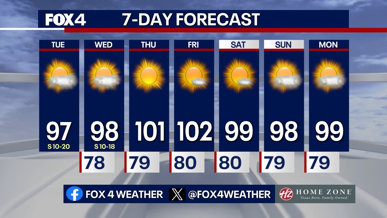
The Source: Information in this article is from FOX 4 Meteorologist Evan Andrews.